| 
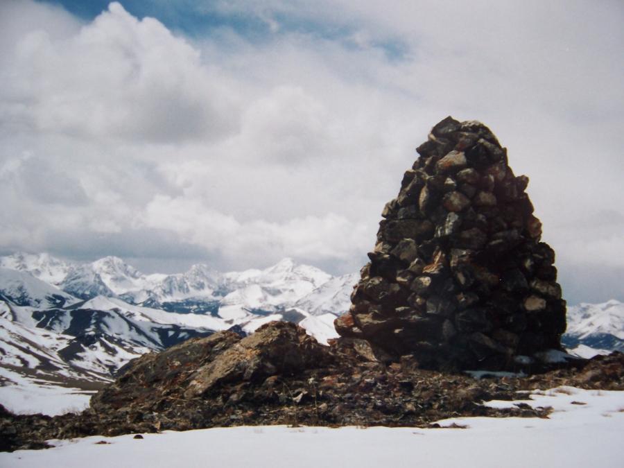
North Donkey el 9555', view SW to Doublesprings Peak.
Rick Baugher photo
|
In all honesty, I did try to research the Donkey Hills of eastern Custer County Idaho. Apart from a couple of government documents, and a few superficial mentions on the web, there isn't much of substance out there. The five 9000 foot peaks in this small mountain group have managed to fly under the radar of the guidebooks. So, bear with me please, in this attempt to describe a magnificently scenic part of undiscovered Idaho.
The Donkey Hills divide Pahsimeroi Valley to the NW and Little Lost River Valley on the SE. This division of Columbia watershed and Lost Rivers system is sometimes called the Great Lost Divide. The nearest towns with gas stations- Arco or Mackay- are about 50 miles distant. Call it lonely cowboy country.
Are the high desert Donkey Hills a separate mountain range or a subrange? To the north, the Summit Reservoir divide el 6728' connects with Lemhi Range, while on the SW side the Long Creek-Dry Creek divide at 7700' connects Donkey Hills with Lost River Range. The lower pass is crossed by the main farm to market graded road that links Pahsimeroi and Little Lost valleys. The road over the higher pass is definitely more adventuresome. To me, it has always seemed logical to consider the Donkey Hills an outlier segment of Lost River Range.
The range highpoint is North Donkey el 9555'. Five miles to the south, overlooking Dry Creek is South Donkey el 9552'. Between these two high points are clustered three more 9000' peaks.
An approach from the SW side (Long Creek Road to Elkhorn Creek two track) is the most reasonable with a 4WD vehicle. There are also ORV approaches from north and south. Private land blocks practical approaches from the east, yet most of the DH is public land managed by the BLM.
Alexander Ross skirted the base of the Donkey Hills with his Hudson's Bay Company (HBC= Here Before Christ) fur brigade in May 1824. Trappers had no luxury of time to go peak bagging. The first white settler, Lorenzo Falls, came to Pahsimeroi Valley in Oct 1869 with a small herd of cattle. He recalled how the local Lemhi and Nez Perce were not pleased with him. General Land Office plats of the area encompassing Donkey Hills were surveyed by James M Porter in 1892. We can infer that he was an early visitor to these peaks. Oscar Meinzer's 1924 map for Idaho Bureau of Mines and Geology first used the nomenclature 'Donkey Hills'. The 1935 USGS Borah Peak quad showed four ranches- The Garrett, Carlson, Swauger, and Summit- occupying land around the base of Donkey Hills.
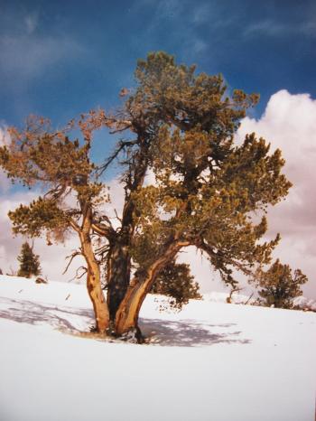
North Donkey el 9555', view SW to Doublesprings Peak section LRR on 5/31/99 from the 1956 USCGS survey tripod. A 1932 USGS brass benchmark placed by EM Buckingham is also in place on this quartzite summit. See gold colored disk lower right. Came in from the north. Saw 20 elk, some monstrous in size. Passed a neat old line shack, then had a hard slog, even with snowshoes, in rotten wet snow.
|
| 
South Donkey el 9552'. Rick Baugher photo.
| South Donkey el 9552', view W to Mt Idaho, Sacajawea, and Borah Peak in LRR on 4/27/96. The limestone escarpment of this mountain rises 2500' out of Dry Creek. On top is this professionally constructed 7' high surveyor's cairn. Although there is no recorded data, I suspect it was built by TM Bannon of the USGS ca 1914. And, although Bannon's personality was modest, he rightfully could have looked across to our Borah, his Beauty, and thought "I own that peak".
|
| 
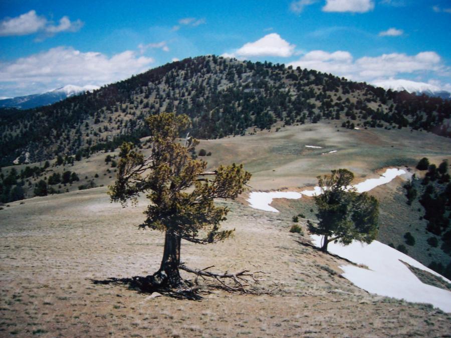
Whitebark pine, Rick
Baugher photo.
| This whitebark pine, hammered by the elements, stands proudly on the summit of Donkey 3 at el 9375' on 4/27/96. Did an approach from the south, amid spitting snow flurries, to reach this snow cap. Iron Creek Point and Bear Mtn in Lemhi Range visible on right horizon.
|
| 
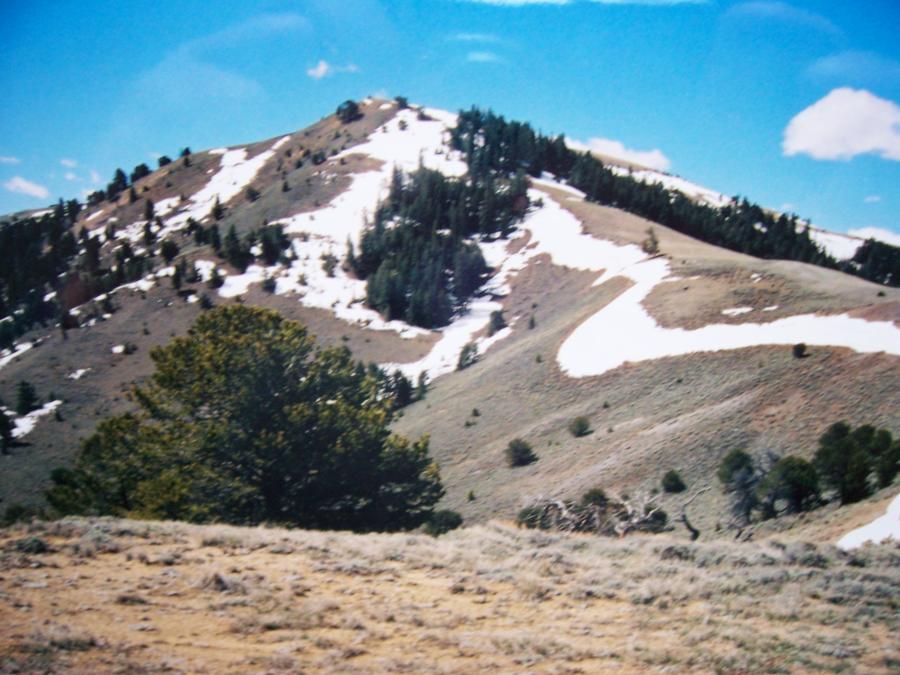
View N to Donkey 4 at el 9291', Rick Baugher photo.
| Again a southern approach, but this time in glorious spring weather. View N to Donkey 4 at el 9291' along the crest of the Great Lost Divide. Columbia drainage on left, Lost Rivers drainage on right. Photo 5/22/05.
|
| 
View S to Donkey 5 at el 9248', Rick Baughter photo.
|
View S to Donkey 5 at el 9248'. On this 5/22/05 I put a tiny cairn on this sweeping gravelly summit. However, there are no delusions of an earliest ascent, as the remains of an old corral were found in the grove of trees 300' below the top.
|
|